



Archaeologists have tested a new way to train deep learning models when real examples of a site type are scarce. Instead of large collections of known sites, the team created simulated archaeological objects and placed them into real lidar terrain data.

The study focused on 12 unusual circular structures in Kisatchie National Forest, Louisiana. The structures looked similar to historic tar kilns, used to extract tar, pitch, and resin from pine trees. Yet their shape differed from known tar kilns found elsewhere in the southeastern United States.
The difference created a problem for machine learning. A model trained on existing tar kilns would struggle to spot the Louisiana structures. Only 12 examples existed, too few for a reliable training set.
The team tested two ways to create artificial training data. Both methods placed simulated kiln shapes into digital elevation models made from lidar data. Lidar records small changes in ground height, helping archaeologists map features hidden beneath forest cover.

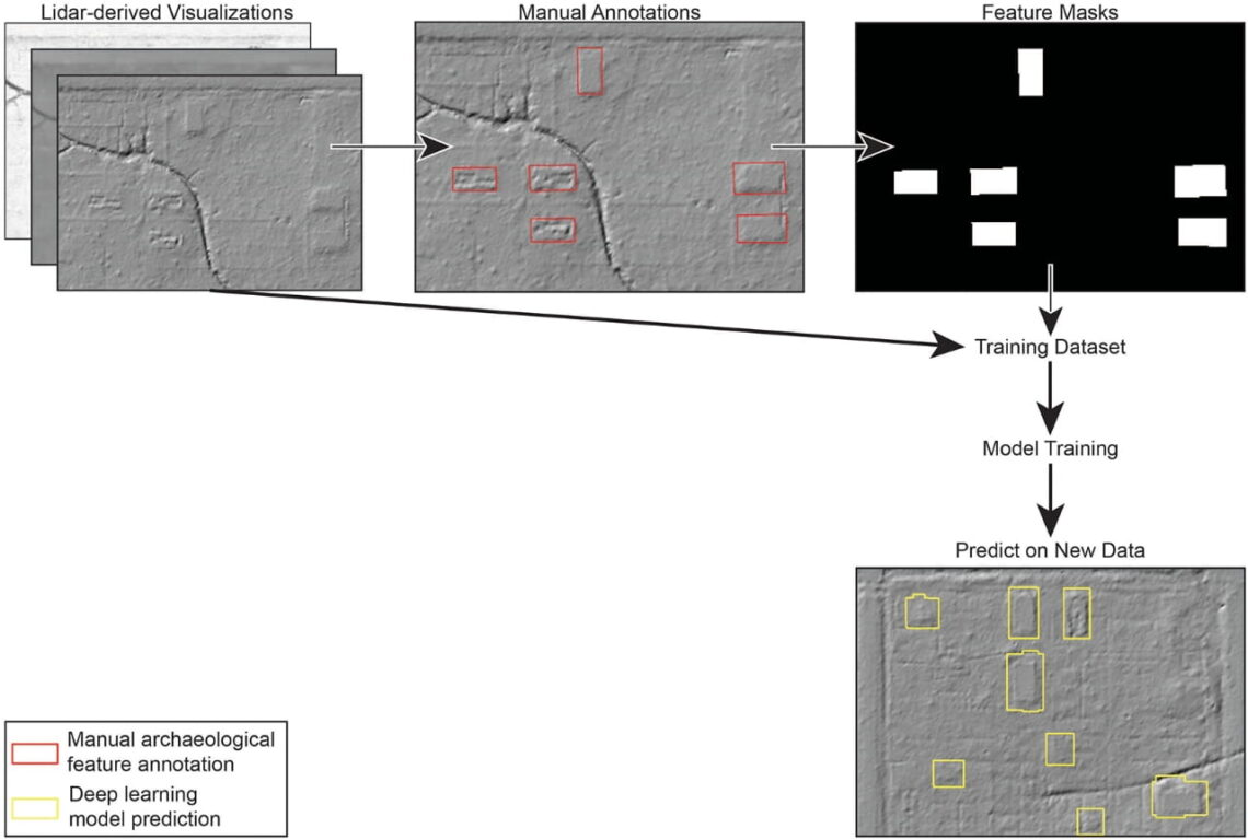
The team trained Mask R-CNN models to identify the objects. The models used tiled lidar images, with 80 percent for training, 10 percent for validation, and 10 percent for testing. Each model trained for 15 rounds before its performance leveled off.
The first model produced 183 predictions. After automatic filtering, researchers reviewed 142. The model found nine of the 12 known targets and six other objects worth checking later.
The second model predicted 2,032 objects, with 709 left after filtering. It found all 12 known targets and 11 additional objects worth further study. Yet 686 of the remaining predictions were false positives.
Many false results came from reservoirs, drainage features, and natural mima mounds. Extra filters removed some errors. Researchers used ground shape to tell mound-like forms from the pit-like shape of the targets.

A third model provided a comparison. Researchers trained it with real tar kilns from South Carolina, after changing the elevation data to better match the Louisiana objects. This model found 11 of the 12 targets and seven additional objects worth checking.
Field work changed the main question. Researchers visited 11 of the original targets and tested two with augers. They found no charcoal-rich deposits, charred pine wood, buried wooden tar pipes, or hard clay floors expected at tar kilns.
The structures also sat near a former World War II military training site. Based on their location and shape, the team concluded they were more likely linked to military training. A wartime training manual suggested the structures could be howitzer emplacements.
Automated detection still needs field checks. The models were good at finding unusual shapes, but many predictions were wrong. Cleaning the results took less time than a pedestrian survey of the same area.
The study points to a way around a major machine learning limit. Simulated training objects could be produced in minutes, while manual labeling of real sites takes much longer.
The team suggests using such models before detailed image marking or field surveys. Larger simulated datasets with thousands of objects could improve future models.
The main gain for archaeology is speed. A model does not replace field work, but it helps narrow a landscape to fewer places worth checking. In this case, the approach helped researchers find targets and reject their first idea about what those targets were.